My Accidental Visit to the Salton Sea

In most places around the world, seeing a lake on the map can bring many things to mind. Lakes are often used for recreation such as swimming, boating, jet-skiing, fishing, and other similar activities. Lakes can also be a great place to enjoy a nice view and relax.
The South Eastern portion of California is notoriously dry, something that a California outsider like myself did not expect. I was surprised to see some of the giant sand dunes along Interstate-8, so much so that I even took a bit of time to check out the North Algodones dunes out of curiosity. Those frankly turned out to be pretty amazing, it was like stepping into a scene from Star Wars or Lawrence of Arabia.
Per recommendation from a friend, after leaving the dunes I went to go check out Salvation Mountain which in itself was an interesting visit, but after feeling like I had been in one dry area after another, taking in the sights at a lake sounded like just the change of scenery I was looking for.

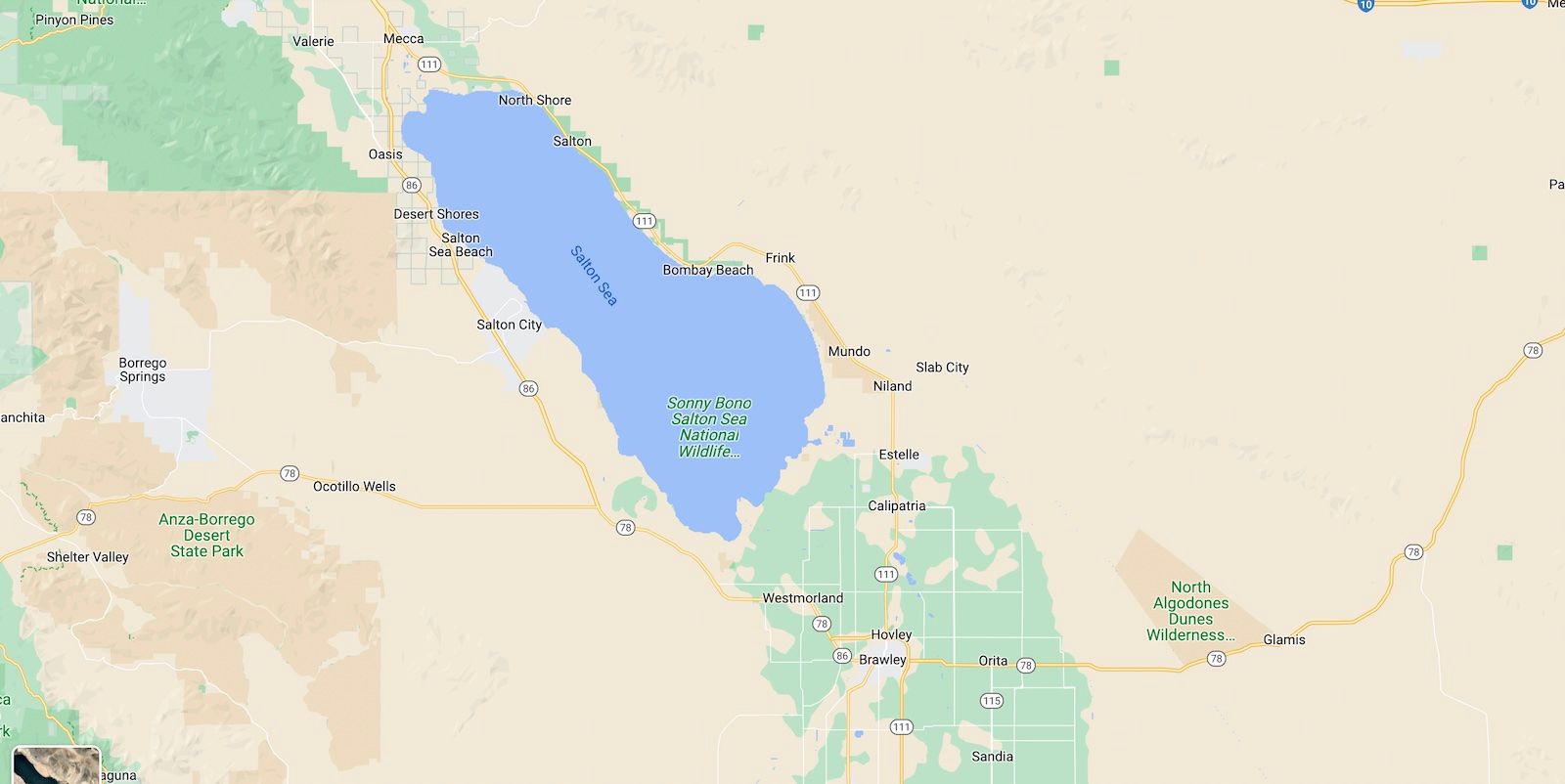
If you look at the Southern California area in Google Maps, it's apparent that the Salton Sea is an oddity out of place. Surrounded by desert, there's no other body of water anywhere close to it. No rivers, no other lakes, it stands alone. The only stream of greenery nearby flows from the south of the sea, likely from using the lake as a source of water.
Driving through Niland was the first sign that something was amiss. What should have been a thriving lake town felt aged, deserted, and wilted. It had a similar feeling to the dusty abandoned West Texas towns that were forgotten in time. There were signs that the town was once thriving. There were husks of diners and shop fronts, but all had been essentially destroyed. You can see this even now just by taking Google Street View and perusing Main St. What I didn't know at the time was that on the other side of Salvation Mountain exists Slab City, an unincorporated colony of nomads, which in itself interesting. I'd probably never visit it myself (nor would I recommend it) but it's worth the quick Google Search to learn a bit about its existence.
Driving up the dry 111, it's increasingly clear that this isn't your ordinary body of water. Docks that have been closed for decades, abandoned camping areas, and closed and abandoned businesses litter the roadside. There is clearly a story here, the hints of a once-thriving area that's been lost and forgotten. Eventually, just off the road there was a sign, "Bombay Beach." This seemed about as good as a spot to turn in as I would find so I made the left turn down the unkempt road.
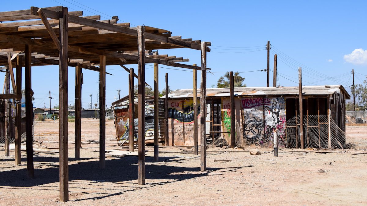
What I was greeted with was one of the biggest surprises yet. Dilapidated houses, some still sadly occupied, next to others that had been destroyed. Crumbling roads just slightly better than dirt roads. I had visited a lot of places on my trips, but Bombay Beach was probably the one place that though I didn't sense imminent danger, I felt the least safe.

As I drove to the back of the (for lack of a better word) development, the destruction of property has become increasingly more prominent, until you reach a road that borders a long-running levee. After finding a gap in the levee, you can then reach the other side.
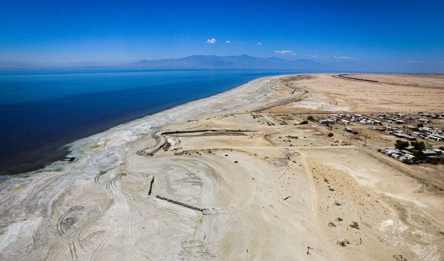
On a hot summer day, you can expect hundreds of lake-goers participating in all kinds of activities but on the other side of that levee, there wasn't another soul in sight. Even taking a moment to scan the feature image of this page which was taken by drone on my visit, there isn't a single person out on the lake. What instead greets you when you walk out of the vehicle - one of the worst stenches I've ever come across.
I'm generally not somebody with a weak stomach; it's one of the few times I've gagged at the smell of anything. It's hard to describe what the smell was, people have described rotting eggs or a strong sulfur smell, but this was much worse. Walking around, the sand had a distinctive crunch to it. One of the other immediate observations is the shoreline is unusually far from the road, the waterline is a few hundred feet out. The receding waterline can also be seen from the feature image on this page.
Because most of my trip was logged in a continuous Snapchat story for my friends, I decided to make a quick landscape pan to post to my feed. Upon checking the filters, there was actually a custom overlay for this area - the words "Salton Sea" over a picture of fish bones. Putting two and two together, I realized that the crunchy sand I was walking on wasn't actually sand.

The area was disgusting, and I was actually ready to leave as soon as I got there. Before heading out, I decided I would do my due diligence and get my drone in the sky for a quick flight for some video, and then head out.
Driving out of Bombay Beach, I noticed that at one intersection two, rough, appearing residents seemed like they were sizing up my vehicle as I was approaching. To be honest, I didn't even stop at that intersection, I just drove out. The roads were so rough my car actually bottomed out, but at that point, I was just trying to leave without incident.
I continued on my way up the 111, passing large farms and actual greenery along the way. I eventually stopped at a Del Taco in Mecca to grab some food and regroup. I couldn't process everything I had seen, it didn't make any sense. How can there be such a large body of water that smelled so awful? This area had clearly once been a tourist destination what happened to cause this area to deteriorate so much? It was a mystery that needed some deep diving.
To summarize a long and fascinating history, the area lies within the Salton Trough, which is a tectonic basin with the lowest point being referred to as the Salton Sink which is the second-lowest elevation in North America.
The entire region (not just the current Salton Sea but even the nearby towns) was once the home of an ancient prehistoric lake, Lake Cahuilla. This lake has had a history of forming, and drying up, with the most recent drying period being around the 1500s. The lake was formed through runoff from the Colorado River, as its course would sometimes change from earthquakes and other tectonic activity.
The current iteration of the Salton Sea was actually formed from a man-made accident in the early 1900s, where again, the Colorado River was altered to flow into the Salton Sink. From here the Sea has had a troubled history. It was maintained by runoff from the river to be used as irrigation for crops and had even become a tourist destination in the 1950s. Numerous developments had even sprung up in the area as it had become sort of an oasis in the desert.
In the 1970s, a series of storms had damaged the area considerably, which included washing out a large number of pesticides from some of the nearby farms into the lake. The salinity and harsh makeup of the lake also means that tilapia are a few of the only fish hardy enough to thrive, sometimes a bit too much. Due to the lack of predators (outside of birds), the tilapia explode in population, and because the lake is standing with without inflow or outflow, the lack of oxygen in the summer heat can result in massive annual dieoffs that contribute to the awful stench.
As I continued on, I found myself listening to the audio of a few YouTube documentaries on the subject to learn more about the area and its history. There's a really interesting (albeit somewhat dry) documentary embedded above that I watched (or listened to) in its entirety as I drove that evening.
The area is an ecological disaster without a feasible solution. I've kept up with updates on the area here and there since visiting, there's been a few proposals but not much has come to fruition. I would eventually like to return if only to satisfy my morbid curiosity to see if it has decayed further.
If you ever find yourself interested in it, dig down the rabbit hole yourself. I had no idea someplace like this even existed.